Skip to content
lakeglance

GeorgiaReservoir, 2,972 acres, Gilmer County, Murray County

Carters Lake conditions today

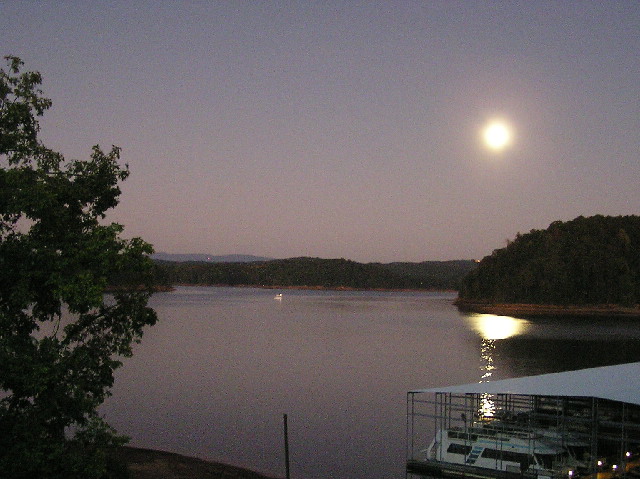
Carters Lake, Georgia
Photo: Ducky1177, Public domain

Right now on Carters

loading

Best window

0pm to 0pm

score

Wind

00kt

Gusts 00

Direction

NE

Blowing from

Air temp

00°F

High

Rain

Dry

next 6 hours

Water level

1,072.36ft

Up 0.65 ft this week

Sailing

Checking

Reading the forecast

Kayak and SUP

Checking

Reading the forecast

Power boating

Checking

Reading the forecast

Fishing

Checking

Reading the forecast

Hour by hour

Next 24 hours
Wind and gusts0 to 30+ ktScoreGood, caution, stay ashoreNightBest windowArrows point where the wind blows to.

Outlook. Monday: NNW wind 1 to 4 kt, gusts to 8 kt, high near 72°F. Tuesday: SSE wind 0 to 2 kt, gusts to 6 kt, high near 75°F.

7-day wind forecast

Live radar

Loads when you scroll here

Radar will load here

LightHeavy

Last hour of NOAA MRMS radar, 1 km resolution. Map data © OpenStreetMap contributors, OpenMapTiles, OpenFreeMap.

Water level

1,072.36ft above sea level

+0.65 ft in 7 days

0.18 ft above the October normal

Sep 25Oct 10Oct 25

Reading from Oct 26, 2026. Shaded band: range of October averages on record; dashed line is the typical level.

Carters Lake was at 1,072.36 ft on October 26, rising 0.65 ft over the past week. That is near normal for October: the typical October level is 1,072.18 ft, so the lake is 0.18 ft above its usual mark.

Lake facts

Type
Reservoir
State
Georgia
County
Gilmer County, Murray County
Surface area
2,972 acres
Elevation
1,073 ft
USGS gauge
02381400, Carters Lake near Carters, GA
Coordinates
34.6072° N, 84.6332° W

Background reading: Carters Lake on Wikipedia

About Carters Lake

Carters Lake covers about 2,972 acres in Gilmer County, Murray County, Georgia and is classed as a reservoir. The water surface sits about 1,073 ft above sea level.

Water level on this page comes from USGS gauge 02381400 (Carters Lake near Carters, GA), about 2 mi from the middle of the lake. Wind, gusts and rain come from the National Weather Service forecast grid that covers the water.

Mid-sized lakes like this one tend to have shifty, gusty wind near shore and steadier pressure in the middle, which is why gust spread matters as much as average speed. Reservoir levels move with releases and inflow, so ramps and beaches can change week to week. The water level page tracks that day by day.

The go or no-go calls above are a starting point, not a guarantee. Read how we score conditions, and always check local rules and posted warnings before you launch.

Carters Lake questions

Is it windy on Carters Lake today?

The National Weather Service forecast for the lake from October 26: Monday: NNW wind 1 to 4 kt, gusts to 8 kt, high near 72°F. The panel at the top of this page refreshes the current wind, gusts and direction when you open it and turns them into a call for sailing, paddling, power boating and fishing.

What is the water level at Carters Lake right now?

Carters Lake was at 1,072.36 ft on October 26, rising 0.65 ft over the past week. That is near normal for October: the typical October level is 1,072.18 ft, so the lake is 0.18 ft above its usual mark.

How big is Carters Lake?

Carters Lake covers about 2,972 acres (4.6 square miles) of surface water.

Nearby lakes

If Carters is blown out, these are the closest alternatives. Tap through for their conditions.